Since the 1970s, federal, state, and local governments have created thousands of environmental regulations. At
M&P Engineering and Land Surveying, we can help you navigate your project or enforcement action through the regulatory web of permits, laws, and regulations.
Our professionals have the knowledge and experience to provide you with effective solutions regardless of the contaminant or the effected media (air, soil, groundwater, and surface water). M&P Engineering and Land Surveying helps you find the best solution for your specific situation.
The following is a list of environmental services we provide:
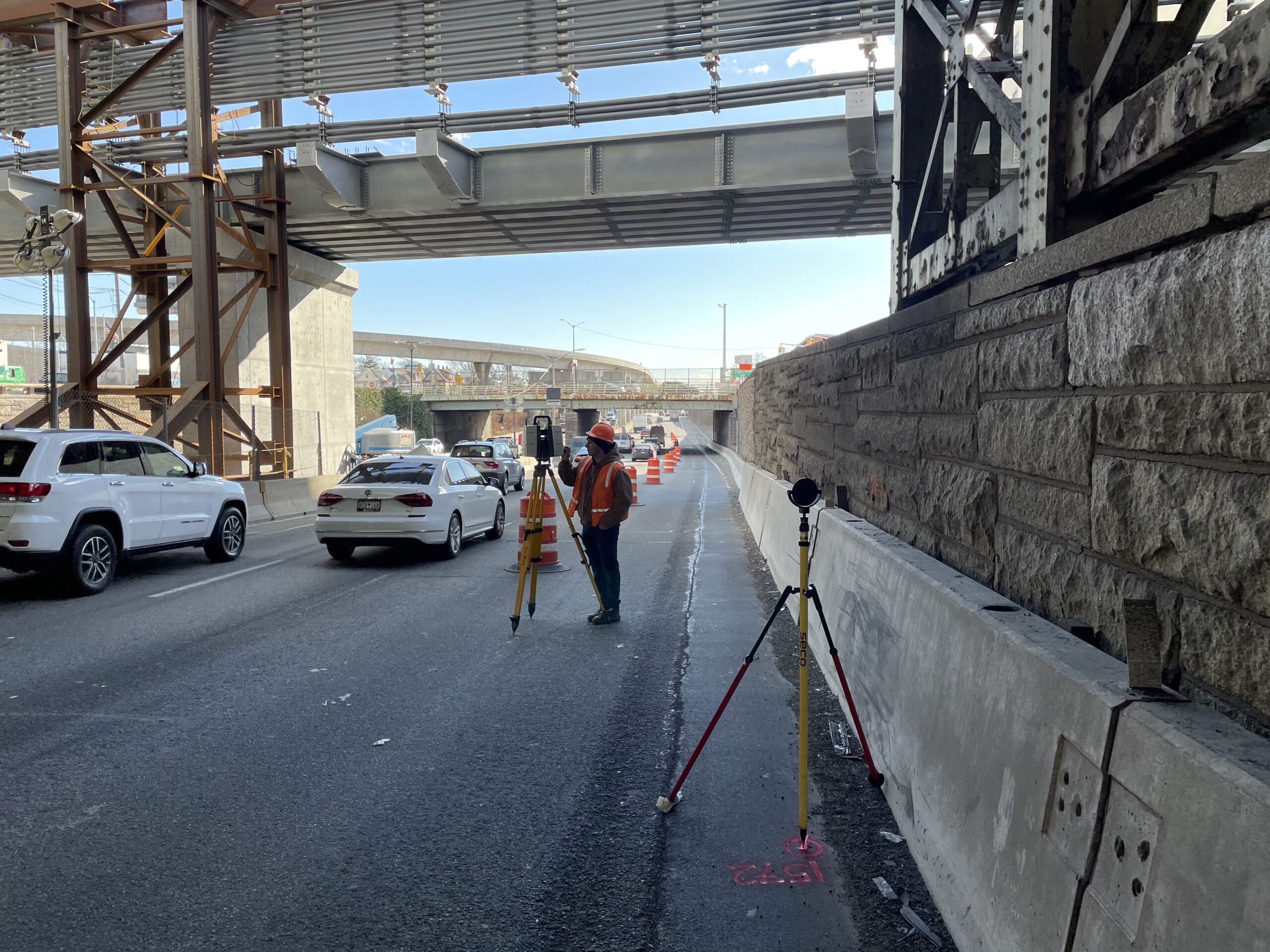
Land Surveying- High Definition scanning and Lidar were utilized to capture over 1 mile section of the Van Wyck Expressway. Our services provided base mapping, topographic surveys, and property boundary (metes and bounds) for the entire project limits and for necessary property acquisitions. High-definition scanning and LiDAR were utilized to capture over a mile section of the Van Wyck Expressway, mapping surrounding city streets, bridges, buildings, and their exterior features. We located marked utilities and identified the directions of manholes and drainage basins. Additionally, we opened all manholes to confirm the direction and depth of flows, as well as the condition interior utilities.