M&P Engineering and Land Surveying Digital Design and BIM Capabilities
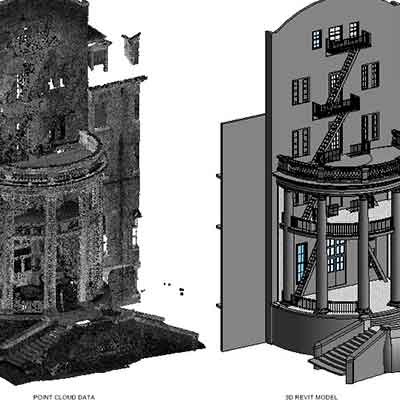
“BIM is a process of creating digital assets that can be used throughout the lifecycle of a project. It is essential to document, communicate, and follow this process to ensure the goals of a project are reached and exceeded. This includes everything from a basic 3D model from scan data to a data-rich model hosted in a common data environment for all stakeholders to collaborate.”
Philip Russo, Director of Digital Design and BIM Services
Lidar and Drone scanning, photometry, and analysis
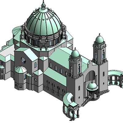
3D Modeling for all disciplines including Civil, Architectural, Structural, Mechanical, Electrical & Plumbing
Leverage Cloud hosted platforms like Cintoo and the Autodesk Construction cloud to manage and collaborate on projects
BIM model coordination using Navisworks or Model Coordination inside the Autodesk Construction Cloud.
Develop BIM Execution plans and project content, train and manage a BIM team as a consultant